
Reviewed · VOLCANO & CRATER HIKES
Santiago: Monte Tchota Natural Park to Pico d’Antónia Hike
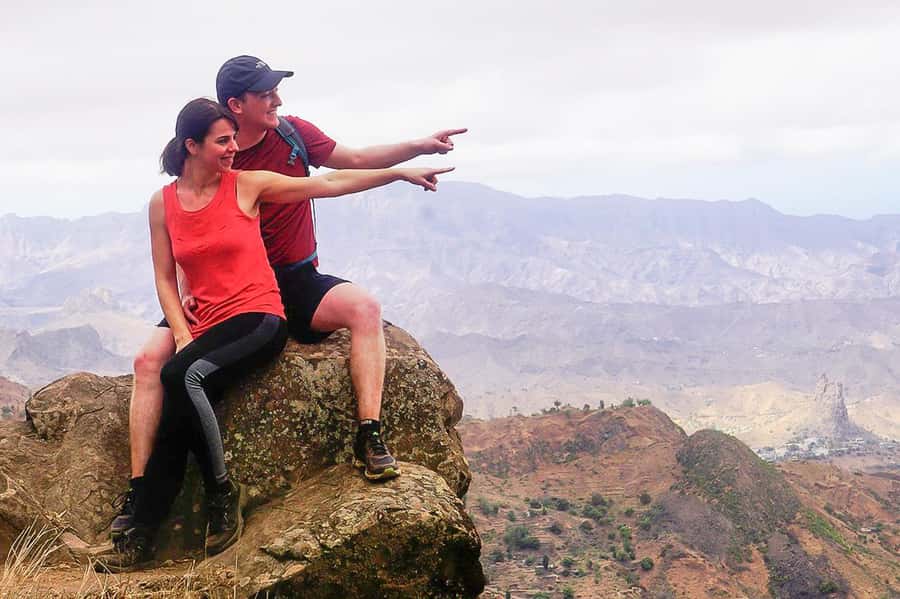
If you like a day that mixes real hiking with huge payoffs, this Monte Txota Natural Park trek on Santiago Island is a smart pick. You start in the cooler, biodiverse Monte Txota area, then climb up to Pico d’Antónia, Santiago’s highest point, where the views can stretch across almost the whole island.
I especially like two things: first, the way the hike moves you through a microclimate that feels different from the coast, even though you’re still on Santiago. Second, the summit viewpoint is the kind of place where you see patterns, valleys, and cities at once, and if the weather cooperates you might even spot Maio and the Volcano of Fogo in the distance. The main drawback to weigh is that this is marked difficult for good reason, with narrow, tilted paths and a serious elevation change (about 660 m gain) over roughly 9 km of trail.
Key things I’d circle before you go
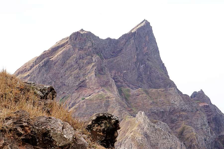
- Santiago’s highest summit: Pico d’Antónia (about 1394 m) for wide island views
- Monte Txota microclimate: cooler temperatures and lots of biodiversity around 800 m
- Weather-dependent sightings: Maio Island and Fogo Volcano only if visibility is good
- A guide who manages the effort: pace and safety matter on the steeper, narrow stretches
- Real legs day: about 4 to 5 hours walking, plus a longer day including driving and breaks
- Simple fuel: a small picnic with soft juice, sandwich, and fruit
Monte Txota to Pico d’Antónia, where the island changes under your feet
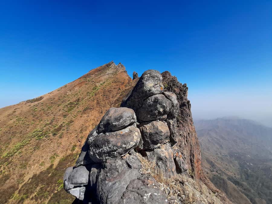
This hike is a classic Santiago contrast story. You begin down in the Rui Vaz area and climb into Monte Txota Natural Park, where the altitude shift (around 800 m) and local conditions create a noticeably cooler feel than the lowlands. On this kind of route, that matters. A cooler start means you can hike steadier, not just harder, and you’re more likely to enjoy the biodiversity instead of rushing through it.
Then you push upward toward Pico d’Antónia (about 1394 m). At that point, the island turns into a map. From the top, you look down into the São Jorge Valley, and you may see more than just Santiago. Weather permitting, you can spot Maio Island and even the Volcano of Fogo in the distance. That combination, park-to-summit, is what makes this trek stand out.
More Hikes in Santiago
- Serra Malagueta: Principal Valley Hike & Lunch with Locals
★ 4.7 · 64 reviews - Praia: Baobab Mysterious Tree, Green Valley & Old City Hike
★ 4.8 · 53 reviews - Santiago: Calabaceira Valley Trek & Visit to Cidade Velha
★ 4.8 · 49 reviews
How the half-day drive sets up your hike
Your day begins with a drive to the Rui Vaz area, where your trek starts. Timing depends on your pickup, but this tour is designed as a full morning-to-midday experience with a total duration of about 6 hours.
That pickup timing is practical. If you’re staying in Praia or São Jorge dos Órgãos, you’ll get transportation that picks you up at your accommodation and returns you at the end of the day. If you’re outside those areas, there’s an extra pickup and drop-off fee, so I’d factor that into your plan early. Either way, the advantage is you avoid the stress of lining up transport while also hiking in a remote part of Santiago.
The climb through Monte Txota Natural Park (cooler air and living trails)
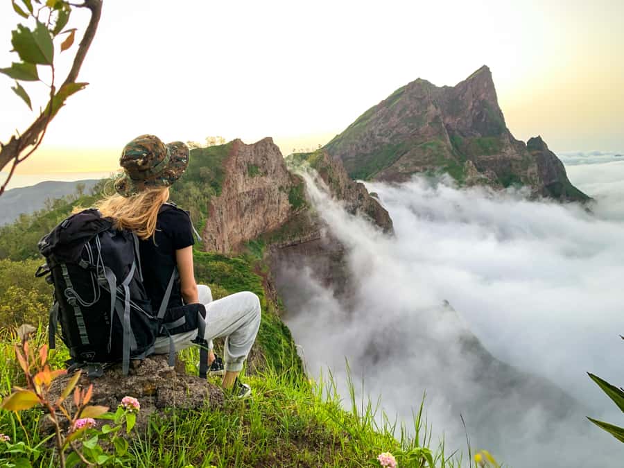
Once you’re moving on foot, you’ll spend a good chunk of your hiking time in Monte Txota Natural Park. The key detail here is the microclimate. Even though you’re on the same island, conditions change with altitude, and around Monte Txota it can feel cooler with more plant life than the dryer lower zones.
This is also where you’ll notice the “biography” of the trail. The path quality is described as tilty and narrow. That means your attention has to be on footing, especially on uneven ground. It’s not the kind of route where you just walk and zone out. You’ll be checking each step, using your hands more than you expect at times, and that helps explain why the difficulty rating is set to difficult.
You’ll likely appreciate the cooler air here, but it can also trick you into going too fast. My advice: start controlled, even if you feel great in the first hour. Save your energy for the final push toward the top.
Pico d’Antónia ascent and the moment the views click into place
Pico d’Antónia is the highest point of Santiago Island at about 1394 m, and the hike works your body to get there. You’re looking at roughly 660 m of elevation gain during the hike, which is plenty for a half-day trek.
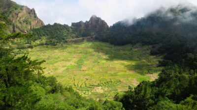
As you get close to the summit area, the trail funnels into that pay-off zone. This is where the panoramic views start to lock in: the São Jorge Valley gets into your line of sight, and the higher you go, the more the island opens up below you.
Then comes the big question: can you see Maio Island and the Volcano of Fogo? The answer is weather dependent. You’re not guaranteed those distant sights, but the trek is still worth it if visibility is only partial. Even without distant islands, the internal geography of Santiago can be impressive from height.
Also, keep expectations realistic. The route includes some level 1 climbing and narrow, tilted sections. That doesn’t mean you need technical gear, but it does mean hiking shoes matter, and hiking pants help protect you as the path gets rougher.
Other climbs on the Fogo crater:
- Hiking: Monte Tchota Natural Park – Pico D’Antónia (1394m) – Longueira
★ 5.0 · 13 reviews - Santiago: Longueira, Pico de Antónia & Monte Tchota Trek
★ 4.8 · 10 reviews - Hiking Pico de Antónia – Summit Adventure & Scenic Views
★ 5.0 · 8 reviews - Fogo Island: Pico do Fogo Volcano Summit Hike
★ 4.6 · 92 reviews
The picnic stop: short break, long impact
You’ll take a stop for a small picnic and views along the way. The picnic is simple but enough for a mid-hike reset: soft juice, a sandwich, and fruit.
Why this is worth planning for: you’re doing about 4 to 5 hours of walking total (not including driving). If you wait until you feel weak to eat, you’ll feel it on the steeper bits. This stop is timed to break the day into chunks. You get a bite, you catch your breath, and you look around while you have the energy to appreciate what’s around you.
If you’re the type who forgets to drink, this is your reminder. Bring water, and sip early. On a climb like this, dehydration creeps up faster than you think, especially if the air feels cooler in Monte Txota.
Returning through Monte Txota before the ride back
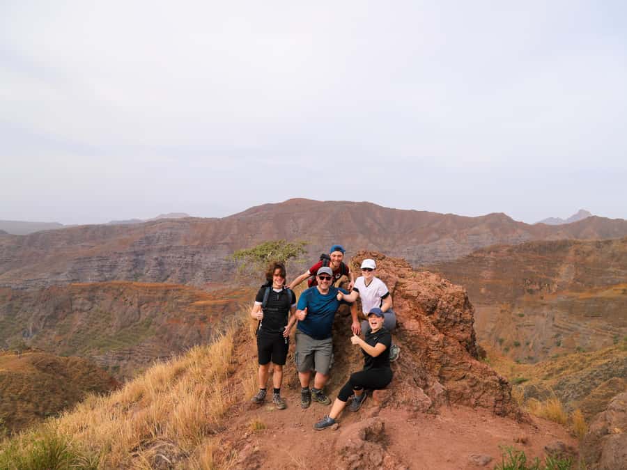
After reaching the summit area, your route brings you back toward Monte Txota Natural Park. The trail type is described as one way, but the day still includes a descent and a return that brings you back to where you can catch your transport.
This part can feel deceptively hard. Descending often burns your legs in a different way than climbing. Add narrow, tilted paths, and your quads and calves will remind you they exist.
Altitude adds another layer. You’ll hit a max elevation around 1400 m and a min around 485 m during the day. Even if you don’t feel symptoms, it’s smart to move steadily and keep your breathing under control on the way down. A good guide will manage the flow so the group stays safe and not rushed.
Guides and driver: why pace and safety are the real value
This isn’t just a “point A to point B” hike. It’s a tough route over narrow, tilted trails with some climbing, so the guide’s role matters.
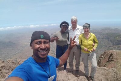
In at least one recent hike, the guide Elder stood out for how he managed the group’s pace and handled harder moments with empathy and safety in mind. Even if you do not get Elder, the practical takeaway is clear: on a difficult trek, the best tours are the ones where your guide adapts to the group and keeps everyone moving safely.
The driver also plays a quiet but important part in the experience. When you’re finishing a 6-hour day, the return ride is when you appreciate a smooth, well-timed pickup and a driver who knows the route.
Price and value: what $100 buys you on a day like this
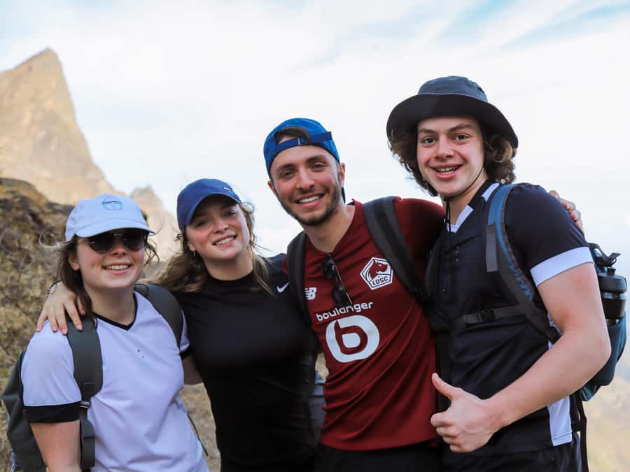
At $100 per person for a 6-hour guided hike, you’re paying for more than instructions. You’re paying for logistics that otherwise eat time and energy: pickup and drop-off in Praia or São Jorge dos Órgãos, transportation to Rui Vaz, a guide, liability insurance, and the picnic.
For a difficult trek with narrow path sections, that safety-and-support package is the value. If you tried to DIY this route, you would need reliable transport, route knowledge, and a plan for a meaningful break and water management. You might save money upfront, but the risk is higher and the day can get stressful.
So here’s how I’d think about it: if you want the hike without the guesswork, this price is reasonable for what you get.
What to bring so the day stays enjoyable
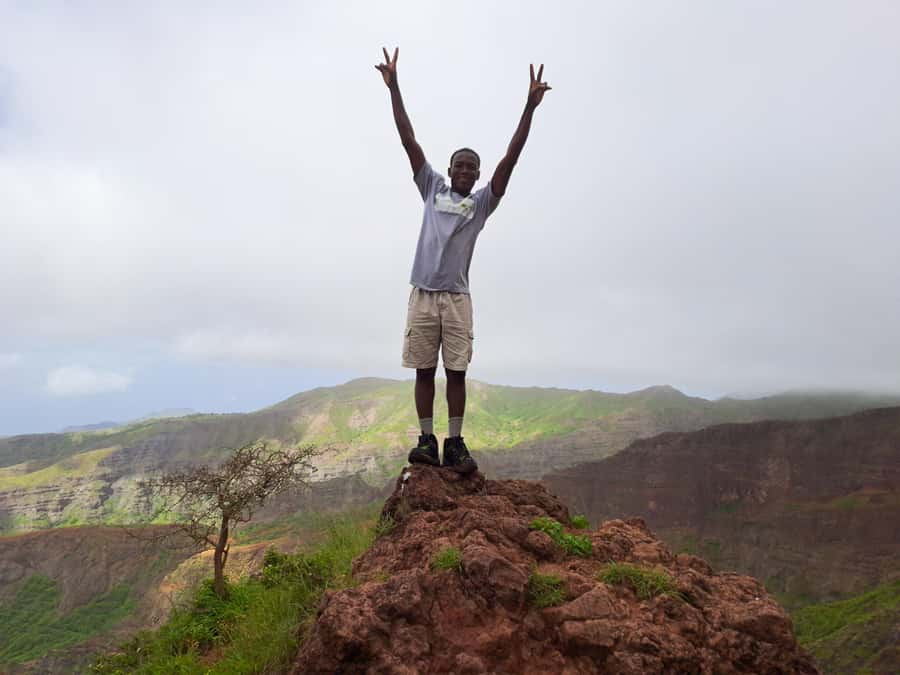
The “bring” list is short, but it’s not optional. This hike is exposed in places, and you’re climbing to high altitude.
Bring:
- Sun hat
- Hiking shoes (non-negotiable for narrow, tilted terrain)
- Sunscreen
- Water (plus a few extra sips early and often)
- Drinks, since you’re on your feet for hours
- Hiking pants, especially from August to November, when conditions can require more leg protection
Helpful extras you might consider, based on a difficult trek:
- A light layer for the higher altitude and wind changes
- A small snack if you’re the type who gets hungry between the picnic and the walk-back
Who this hike suits, and who should skip it
This trek is suitable for walkers with some fitness and no health problems. It’s marked difficult, so if you’re new to hiking or you struggle on steep uneven paths, this may feel like too much.
Not suitable for:
- Pregnant women
- People with mobility impairments
- Wheelchair users
- People with respiratory issues
Also, it’s for ages over 16. That matters because the day expects an active hiking rhythm, not a sightseeing pace.
If you’re comfortable hiking 4 to 5 hours and you want a summit viewpoint with serious views, you’ll likely love this. If your goal is an easy stroll, pick something gentler.
Booking and planning tips that actually help
A few small things can make this day smoother.
First, match your footwear and clothes to the trail quality. Tilty, narrow paths mean you want grip and protection. Hiking shoes plus hiking pants will make the hike feel safer.
Second, plan your expectations around weather. The best distant views, like Maio Island and the Volcano of Fogo, are weather permitting. Even if those sights are faint or absent, Pico d’Antónia still delivers big panoramic views and a strong sense of the island’s layout.
Third, if you’re deciding between private and small group formats, think about your pace. Since the route is narrow and steep in spots, having the group run at a pace that suits you is a plus.
Should you book the Monte Txota to Pico d’Antónia hike?
Book it if you want a real Santiago Island hike with a summit payoff, you’re okay with difficult terrain, and you value a guided day that handles safety, transport, and a proper stop for food and views.
Skip it if you need an easy hike, you have respiratory issues, or you’re not comfortable with narrow, tilted paths and some climbing. Also, if you hate driving to remote trailheads, factor that in because your day includes time on the road.
If you’re the kind of person who loves cool forest air higher up, sharp climbs, and panoramic viewpoints that make the island feel like a map, this is a strong yes. You’ll come away tired in a good way, and you’ll remember the look from Pico d’Antónia long after you’ve returned to town.
FAQ
How long is the Monte Txota Natural Park to Pico d’Antónia hike?
The total experience is about 6 hours.
What distance and elevation change should I expect?
You’ll hike roughly 9 km, with about 660 m of elevation gain. The max elevation is around 1400 m and the min is around 485 m.
Is the hike one-way or round-trip?
The trail type is described as one way, and the route includes a return that brings you back toward Monte Txota Natural Park before the ride back.
What’s included in the tour price?
Pickup and drop-off (in Praia or São Jorge dos Órgãos), transportation, a tour guide, liability insurance, and a picnic with soft juice, a sandwich, and fruit.
Where does the tour start and end?
Your day starts with a drive to the Rui Vaz area, where the hike begins, and it ends with returning to Monte Txota Natural Park and then riding back to your accommodation.
What language will the guide speak?
The tour guide is available in English, French, Spanish, and Portuguese.
Who shouldn’t do this hike?
It is not suitable for pregnant women, people with mobility impairments, wheelchair users, and people with respiratory issues. It’s also for travelers over 16 years old.
More Praia Walks with Real Climb
- Serra Malagueta Natural Park Hike & Relaxing Swim at Tarrafal Beach
★ 5.0 · 30 reviews - Serra Malagueta Natural Park: Hike to Gongon Valley & Lunch
★ 4.8 · 22 reviews - Santiago Island: 4-Hour Calabaceira Valley Hike & Guided Tour to Cidade Velha
★ 5.0 · 18 reviews - Santiago: Trek from Serra Malagueta to Rabelados Community
★ 5.0 · 16 reviews
Just added around Praia
- Best of Santiago Island: Cidade Velha, Workshop & Tarrafal Beach Tour★ 4.5 · 3 reviews
- Santiago Island: Private Airport Transfer to Praia or Vice Versa★ 5.0 · 3 reviews
- Hiking Águas Belas Cave★ 4.5 · 3 reviews
- Cape Verde: Best Hikking Trails of Santiago Island – 6 Days★ 5.0 · 3 reviews
- Praia City Tours★ 3.4 · 3 reviews
- Praia: Plateau and Cidade Velha Guided Tour★ 5.0 · 3 reviews
- Tarrafal Bay Boat Trip and Beach Day★ 4.4 · 3 reviews
- From Praia: Full-Day Guided Fogo Island Tour★ 4.2 · 3 reviews
Volcano & Crater Hikes, compared.
Hiking: Monte Tchota Natural Park – Pico D’Antónia (1394m) – Longueira
Read our review →
Hiking Pico de Antónia – Summit Adventure & Scenic Views
Read our review →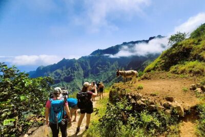
Trekking Cova de Paúl Volcano Crater – Ribeira de Paúl
Read our review →
Browse the lists this tour appears in