
Reviewed · VOLCANO & CRATER HIKES
Hiking: Monte Tchota Natural Park – Pico D’Antónia (1394m) – Longueira
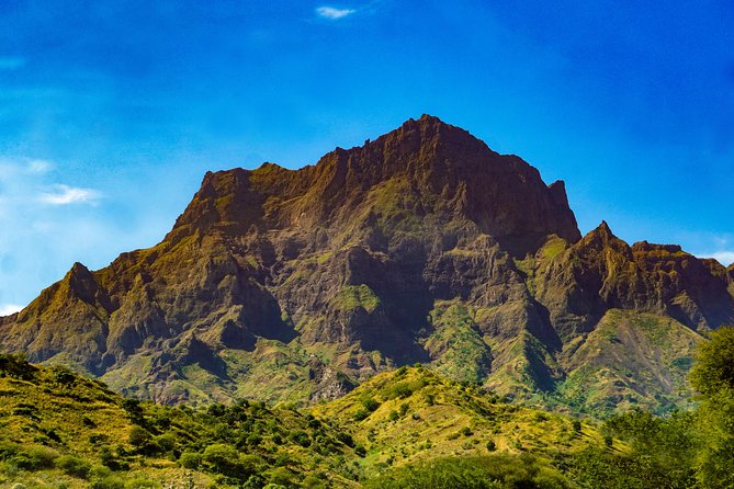
Monte Tchota Natural Park is a great pick on Santiago because the day is more than a workout. You climb to Pico d’Antónia (1394m), the highest point on the island, and then you spend the afternoon walking through Longueira mountain villages and working farmland. If the sky behaves, you can even catch a far-off view toward Fogo.
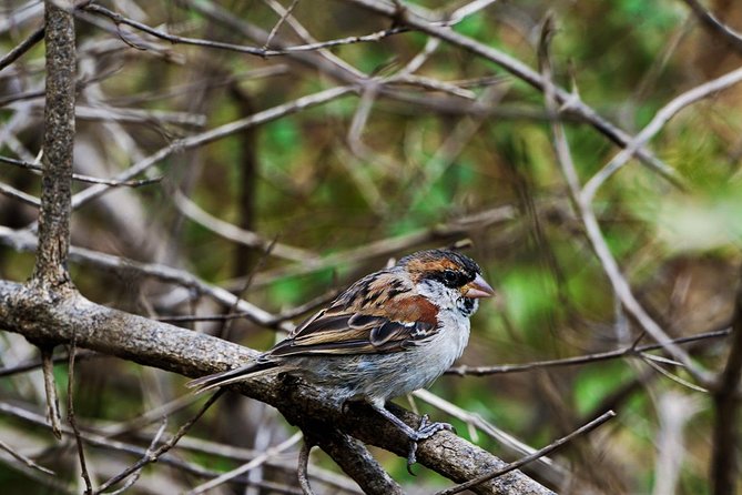
I love two things here. First, the combo of fitness and real learning, with a guide pointing out endemic plants and birds and explaining what you’re walking past. Second, the picnic lunch at the top, so the effort actually has a payoff, not just another viewpoint photo.
The main drawback is the trail reality. This is rated difficult, with narrow, tilted paths and some short climbing spots, so it’s not the kind of hike you can coast through on flimsy footwear.
Key things I’d circle before you go
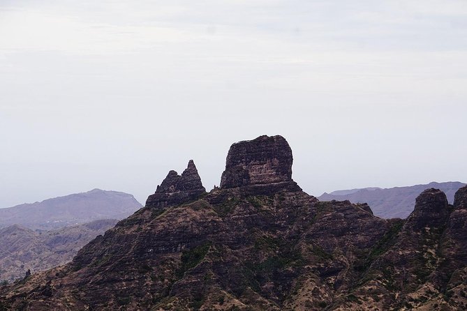
- Santiago’s highest point: reach Pico d’Antónia at about 1394m for big island payoff.
- Guided nature and farming: endemic species, then agriculture depending on the season.
- One day, 9 km and real ups and downs: about 660m gain but roughly 1280m loss, plus a descent through steep, rocky sections.
- Longueira culture on foot: carved mountain houses and a visit with a local family.
- Small group pace: max 8 travelers, which matters on narrow, uneven paths.
Monte Tchota and Pico d’Antónia: Why this Santiago hike is a smart day
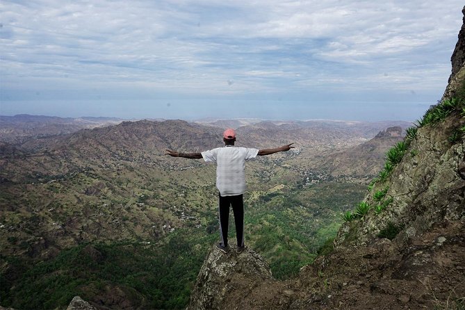
If your Cape Verde trip includes time on Santiago, this hike gives you more “island texture” than a simple viewpoint trail. You start with nature in Monte Tchota Natural Park, then you switch gears to human-scale landscapes in Longueira, where farms and homes are shaped by the mountains.
The best part is how the day is structured. You don’t just grind uphill and turn around. You work your way toward the highest point on the island, stop for lunch, then continue on a route that naturally transitions into agriculture and mountain village life. That makes it feel like you spent half a day with the island, not half a day inside a single photo spot.
And yes, the views matter. The route is high enough that you’re likely to feel like you’re above the island’s normal clutter, and on good weather you may spot Fogo Island lost on the horizon. But the real value is that the scenery comes with context.
More Hikes in Santiago
- Serra Malagueta: Principal Valley Hike & Lunch with Locals
★ 4.7 · 64 reviews - Praia: Baobab Mysterious Tree, Green Valley & Old City Hike
★ 4.8 · 53 reviews - Santiago: Calabaceira Valley Trek & Visit to Cidade Velha
★ 4.8 · 49 reviews
Route reality check: difficulty, distance, and what “tilty, narrow” means
Let’s translate the numbers into something you can trust with your legs. You’re looking at about 9 km of walking total, around 4 to 5 hours of walking time, plus time for stops.
The elevation stats are the big clue you’re in “real hike” territory:
- Elevation gain: about 660m
- Elevation loss: about 1280m (you descend more than you climb)
- Max elevation: around 1400m
- Min elevation: around 485m
- Trail type: one way
The trail quality is described as tilty, narrow, and the route includes places where you’ll need some level 1 climbing. That doesn’t mean technical mountaineering gear, but it does mean you should plan for careful footwork. If you hate heights you might still be fine, but you should expect to concentrate on where your feet land during the steep sections.
If you’re deciding between this and an easier walk, be honest about your hiking routine back home. This one is for travelers who can handle a difficult half-day and won’t get rattled by uneven paths.
Morning start from Praia: how the day begins and why timing matters
You start at 8:30am with pickup from your hotel in Praia. The day is designed to move steadily, which helps for two reasons. First, early light can be kinder for views. Second, starting earlier gives you a better shot at stable weather and clearer skies during the high-point picnic.
The route includes a quick first segment simply to get you out of the city and into the countryside. From there, the main action begins when you enter the Monte Tchota Natural Park walking zone.
This is also where small-group size becomes a comfort factor. With a maximum of 8 travelers, you’re less likely to feel like you’re being dragged or lost in a crowd. On narrow trail, that difference is real.
Monte Tchota Natural Park: endemic plants, birds, and learning that actually sticks
Once the hike starts in Monte Tchota Natural Park, the focus shifts from “just walking” to “noticing.” Your guide leads you through the unspoilt natural area, pointing out endemic plants and birds as you go.
Why I like this approach for first-time hikers: it keeps your brain busy in the best way. When you’re breathing hard, having something specific to look for makes the climb feel less monotonous. Instead of counting minutes until a rest stop, you’re collecting small details about the island’s living systems.
The park walk also sets up the rest of the day. Santiago’s landscape doesn’t feel random once you connect plants and birds to what you later see in the farms. Even if you only catch a few key names, you end up with a stronger mental map of how people and nature share this mountain world.
Other climbs on the Fogo crater:
- Santiago: Monte Tchota Natural Park to Pico d’Antónia Hike
★ 4.8 · 43 reviews - Santiago: Longueira, Pico de Antónia & Monte Tchota Trek
★ 4.8 · 10 reviews - Hiking Pico de Antónia – Summit Adventure & Scenic Views
★ 5.0 · 8 reviews - Fogo Island: Pico do Fogo Volcano Summit Hike
★ 4.6 · 92 reviews
Pico d’Antónia summit time: picnic lunch and panoramic hopes
The hike’s core goal is the summit area of Pico d’Antónia, Santiago’s top peak at 1394m. You’ll hike up to the walking point of the summit, about 4.2 km during the ascent portion, while your guide keeps the pace manageable and safe.
Then comes the reward: a tasty picnic lunch on top. This matters more than you might think. A picnic stop is a built-in reset button. You’ll get a chance to refuel and cool down before the descent, and it turns the summit from an endurance checkpoint into a real break.
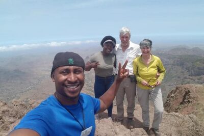
Views are described as panoramic weather permitting, and on clear days you may see Fogo Island on the horizon, including its volcano shape. I’d treat that as bonus scenery rather than a guarantee, but the route positioning gives you a solid chance if conditions are right.
The steep rocks and the descent: what to expect after lunch
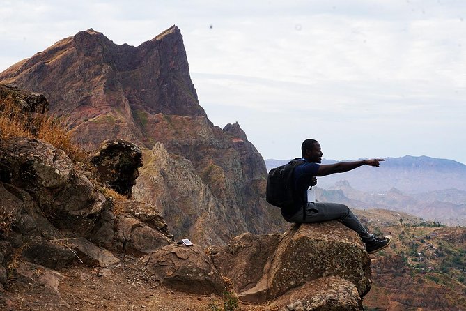
After the picnic, you descend through steep and rocky sections. The route description specifically notes descending steep rocks, then continuing through agricultural fields.
This is where preparation pays off. When you’re tired, uneven footing is harder to manage. You’ll want shoes with good grip, and you should be ready to slow down and move carefully rather than keep a fast walking cadence. The good news is that guides can manage group pace, and on small groups you’re less likely to get pressured into rushing.
Also, remember the elevation loss is bigger than the gain. That’s a common pattern in mountain days, but it still means your knees, ankles, and quads will feel the work. If you usually skip stretching, do not skip it today.
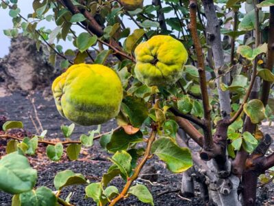
Longueira farms and seasonal crops: corn, mango, coffee, tomatoes
As you continue after the descent, you walk through the agricultural fields of Longueira. The key detail is that what you see depends on the season.
Depending on when you go, you might see:
- corn
- mango
- coffee
- tomatoes
That seasonal change is valuable because it makes your hike feel tied to the time you’re actually visiting. Instead of a static landscape, you’re seeing a working mountain system that changes with the year.
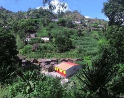
You’ll also likely notice how paths and fields connect to homes carved into the mountains. This is not just countryside scenery. It’s a route where agriculture shapes movement, and movement shapes daily life.
Longueira mountain houses and a family visit: why this part matters
One of the most memorable parts of this day is the final stretch: walking among houses carved into the Longueira mountains, then visiting a local family to hear about daily life.
Even if you don’t speak the local language perfectly, this is the section that turns the hike into a cultural encounter. The carved houses are a visual story, and the family visit gives it a human voice.
Practical note: respect the pace. During cultural visits, people may move at a slower rhythm than a hiking group. If you keep your energy steady and stay patient, you’ll get more from the conversation instead of feeling rushed through it.
This is also the section that many people remember months later, because it’s the moment the island stops being scenery and starts being a place with routines, work, and local knowledge.
Guides, small groups, and the safety factor on narrow trails
This hike is built around an experienced local guide, and that matters most on narrow, tilted paths. When the trail is uneven, the best tool is good leadership: knowing where to place feet, when to pause, and how to keep everyone moving as a unit.
The group size cap of 8 travelers helps a lot. On narrow sections, a small group is easier to manage and easier to keep safe. You also get better access to questions, since you’re not stuck yelling across a big line of people.
One more reason I like this setup: the itinerary includes both a nature component and a cultural component, so the guide isn’t only focused on getting you to the summit. They’re helping you understand where you are and why it’s worth paying attention to.
What to pack and how to hike smart at 1400m
You should plan this hike like a proper mountain outing, not a light stroll. Here’s the practical checklist based on the route recommendations.
Bring:
- hiking shoes (important for grip)
- hiking pants (especially recommended from August to October)
- a hat
- sunscreen
- water
- a walking stick (highly recommended)
You’ll also want to bring what keeps you comfortable on a long day. Since the hike is difficult and involves steep descents, walking sticks are more than a nice-to-have. They help take pressure off your knees during downhill sections and can improve confidence on narrow paths.
Pacing tip: ask your guide to keep you on a steady rhythm. The safest way to handle a difficult half-day is to avoid going too fast early. You’ll feel better at the summit stop and you’ll be less drained during the rocky descent.
Price and value: is $98.72 worth it?
The price is $98.72 per person, and it’s sold as a structured guided experience for about 6 hours total (including travel time). Based on what’s included, the value looks solid for a few reasons.
First, you get guided interpretation. The day includes Monte Tchota Natural Park learning plus the Longueira family visit, so you’re paying for more than movement. You’re paying for context, safety, and a route that stitches nature and culture together.
Second, there’s pickup and drop-off from Praia, which matters on Cape Verde where it can take effort to coordinate ground transport. You also get a mobile ticket, which is the kind of small modern convenience that saves time on arrival.
Third, the admissions side is listed as free for ticket items during the stops you’ll make. That means your money is mainly going toward guide time and logistics rather than entry fees stacking up.
The one cost-related reality: this hike requires a strong fitness level and is rated difficult. If you book it when you’re undertrained, you may feel like you paid for suffering instead of an experience. But if you’re ready, this is a high-reward day that covers the island’s nature, farmland, and carved mountain homes.
Who should book this Monte Tchota hike (and who should think twice)
This is best for:
- hikers with strong physical fitness
- travelers who like guided nature plus culture on the same day
- people who can handle a difficult trail with narrow and rocky sections
- anyone who wants to see Santiago beyond city streets and beaches
It may not be ideal if:
- you have health problems that make steep descents hard
- you struggle with uneven or narrow trails
- you want an easy, fully relaxed walk with minimal effort
There’s also a clear age guideline: it’s for people over 16 years old, so plan accordingly if you’re traveling with teens.
Should you book this Monte Tchota to Pico d’Antónia hike?
If you want one memorable hiking day on Santiago that mixes high-point views, endemic wildlife learning, seasonal farmland, and a real family encounter, this is a strong choice. The small group size, guided safety, and the picnic stop make it feel like a complete day, not just a route you struggle through alone.
Book it if you can commit to the difficult trail demands. Skip it if you need a low-effort option, because the narrow paths and steep rocky descent will shape the experience more than the view will.
And if weather is uncertain when you’re in Praia, keep your fingers crossed. The panoramic payoff and possible Fogo sighting are weather dependent, so being flexible helps.
FAQ
How long is the Monte Tchota Natural Park hike to Pico d’Antónia?
The duration is about 6 hours total, with around 4 to 5 hours of walking time.
What time does the tour start?
The start time is 8:30am.
Is pickup from Praia included?
Yes, pickup is offered at your hotel in Praia.
How far do you walk and what is the route type?
You’ll walk about 9 km, and the route type is listed as one way.
What is the difficulty level?
The hike is rated difficult, with narrow, tilty trails and some level 1 climbing.
What is the highest point you reach?
You’ll reach about 1394 meters at Pico d’Antónia, the highest point on Santiago Island.
What should I bring for the hike?
Bring hiking shoes, hiking pants (especially recommended August to October), a hat, sunscreen, and water. Walking sticks are highly recommended.
Is there a picnic lunch?
Yes, there is a tasty picnic lunch on top of the mountain.
Who can join the tour?
The activity is for travelers over 16 years old, and it’s recommended for people with strong physical fitness and no health problems that could be affected by hiking.
What is the weather and cancellation approach?
The experience requires good weather. If canceled due to poor weather, you’ll be offered a different date or a full refund. Free cancellation is available up to 24 hours in advance for a full refund.
More Praia Walks with Real Climb
- Serra Malagueta Natural Park Hike & Relaxing Swim at Tarrafal Beach
★ 5.0 · 30 reviews - Serra Malagueta Natural Park: Hike to Gongon Valley & Lunch
★ 4.8 · 22 reviews - Santiago Island: 4-Hour Calabaceira Valley Hike & Guided Tour to Cidade Velha
★ 5.0 · 18 reviews - Santiago: Trek from Serra Malagueta to Rabelados Community
★ 5.0 · 16 reviews
Just added around Praia
- Cape Verde: Best Hikking Trails of Santiago Island – 6 Days★ 5.0 · 3 reviews
- Best of Santiago Island: Cidade Velha, Workshop & Tarrafal Beach Tour★ 4.5 · 3 reviews
- Santiago Island: Private Airport Transfer to Praia or Vice Versa★ 5.0 · 3 reviews
- Hiking Águas Belas Cave★ 4.5 · 3 reviews
- Praia City Tours★ 3.4 · 3 reviews
- Praia: Plateau and Cidade Velha Guided Tour★ 5.0 · 3 reviews
- Tarrafal Bay Boat Trip and Beach Day★ 4.4 · 3 reviews
- From Praia: Full-Day Guided Fogo Island Tour★ 4.2 · 3 reviews
Volcano & Crater Hikes, compared.
Monte Tchota Natural Park to Pico d’Antónia Hike
Read our review →
Hiking Pico de Antónia – Summit Adventure & Scenic Views
Read our review →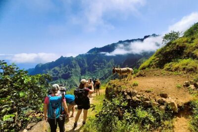
Trekking Cova de Paúl Volcano Crater – Ribeira de Paúl
Read our review →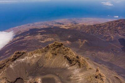
Browse the lists this tour appears in